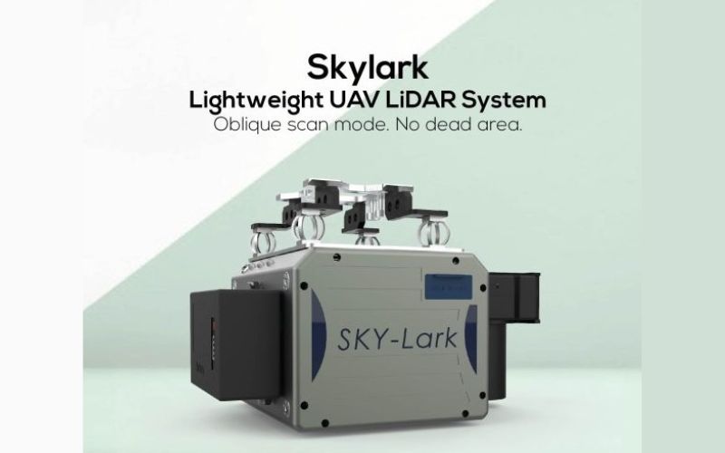
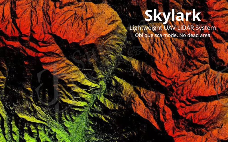
Skylark
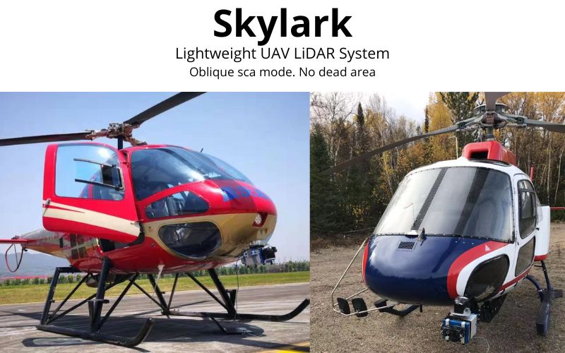
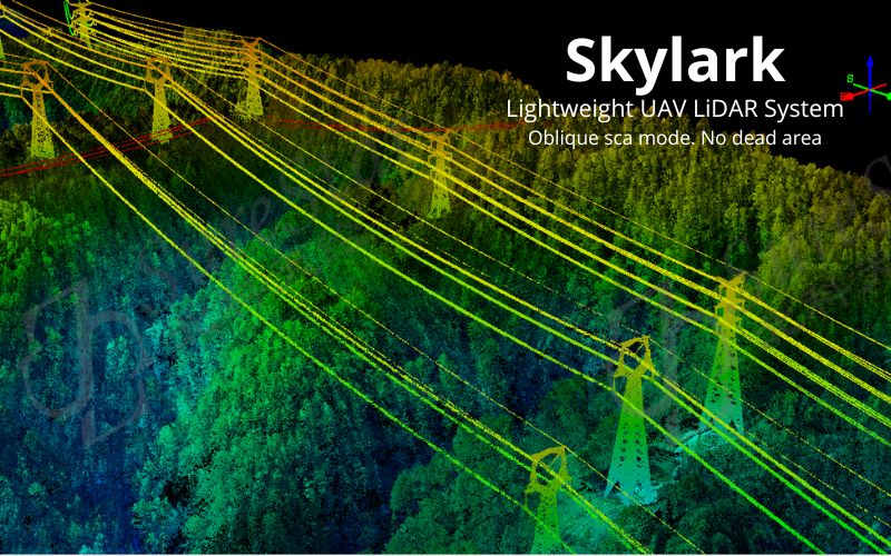
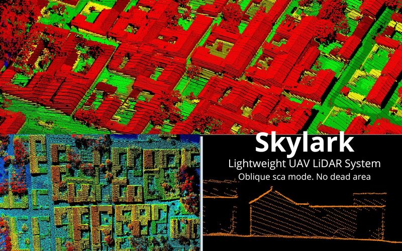
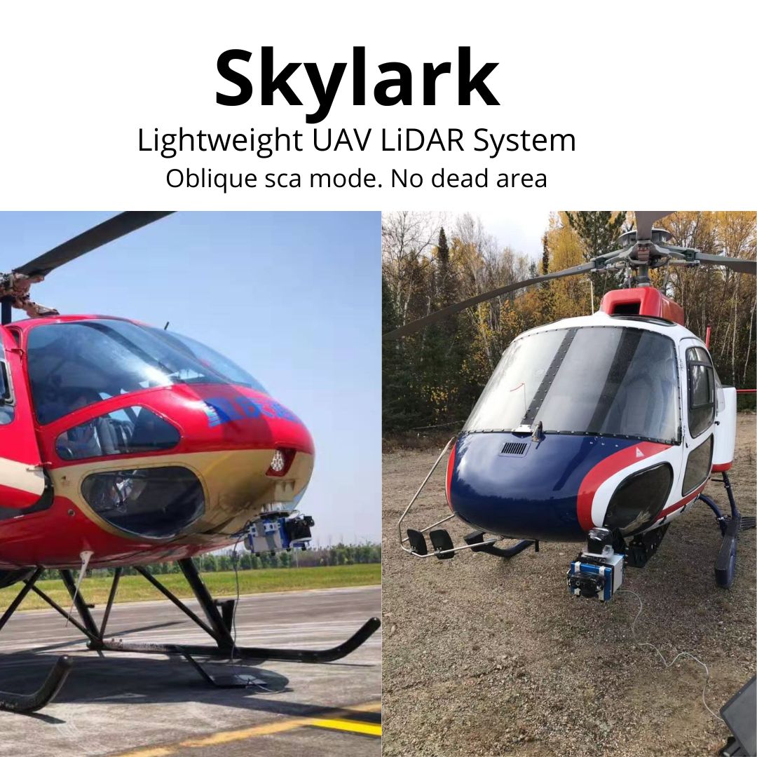
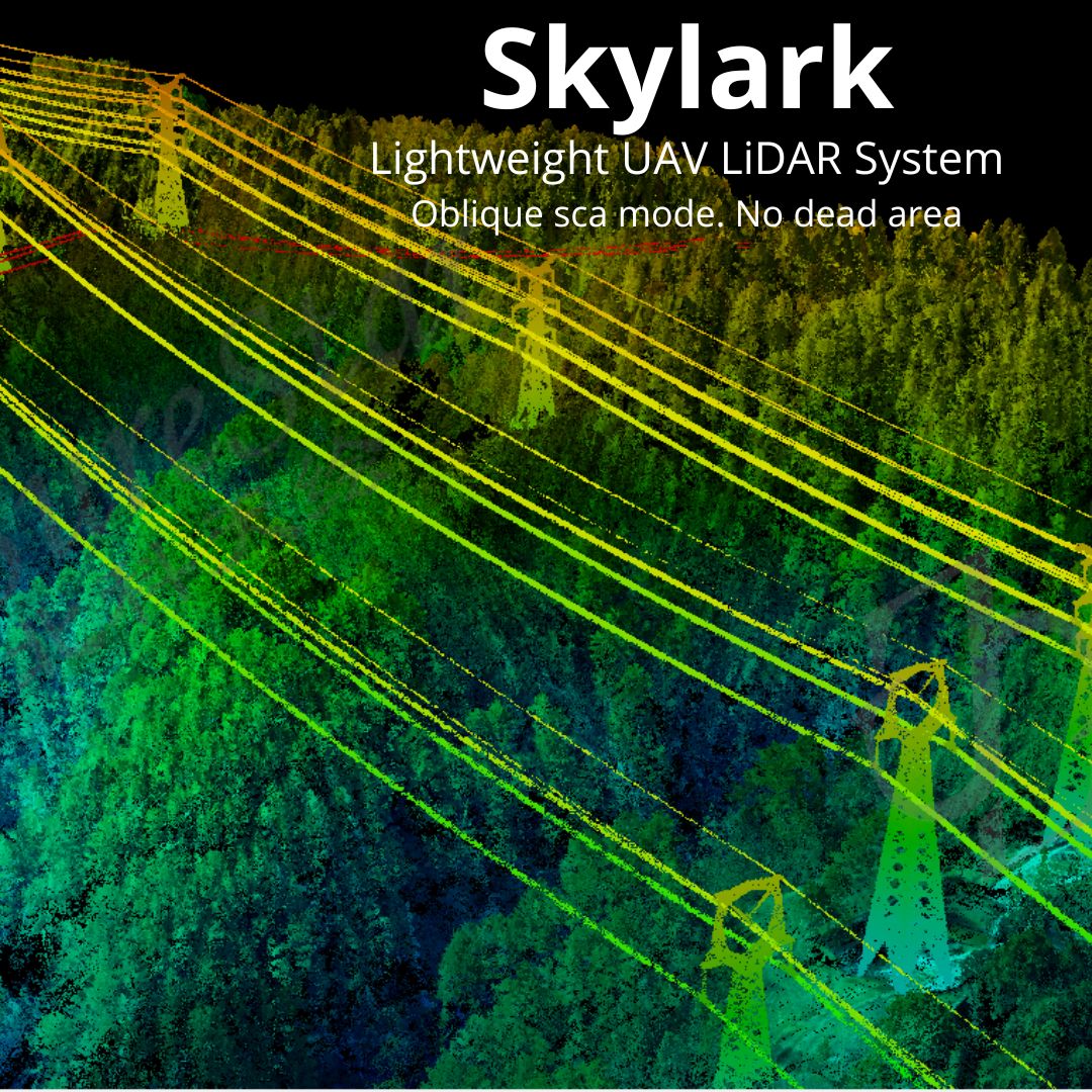
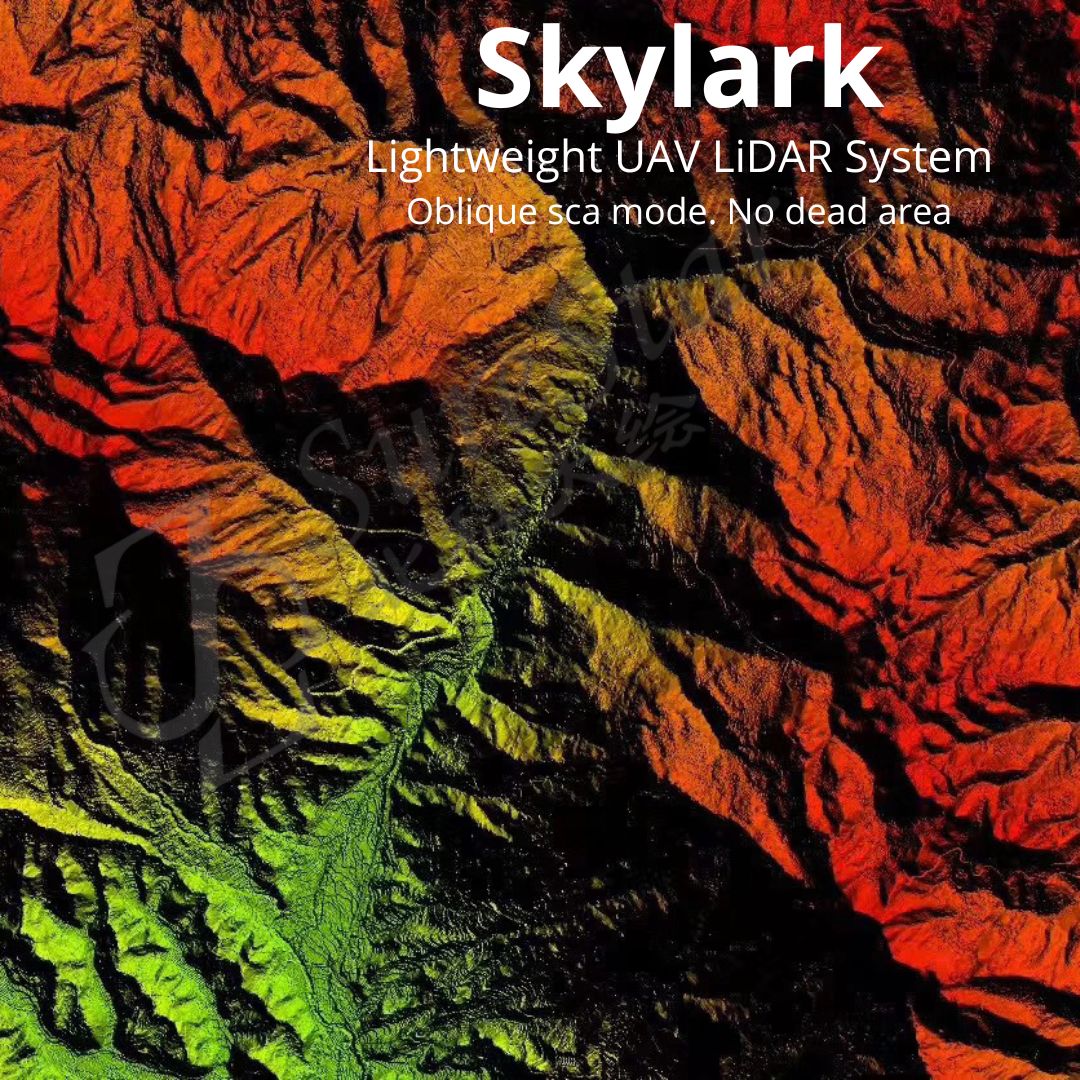
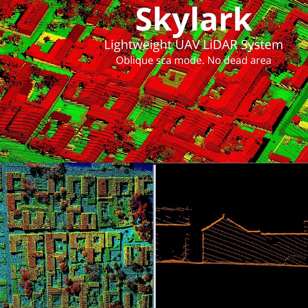
The Skylark is SureStar’s best in class mapping LiDAR system, specifically designed for users that require very dense point clouds from a compact and highly versatile instrument. With acquisition ranges up to 1500 meters and a high point density, the Skylark is the perfect choice for 1:500 topographic mapping and other high-density survey grade point cloud applications. Its high point acquisition rate means the Skylark can be mounted to flying platforms ranging from large multi-rotor UAV’s to fixed wing aircraft (including Helicopter) with flying speeds of 100km/h. With its cutting edge technology, the Skylark has been used for applications including transmission line inspection, topographic mapping, 3D city modeling, flood monitoring, geological disaster assessment and forestry surveys to name a few.
Specification
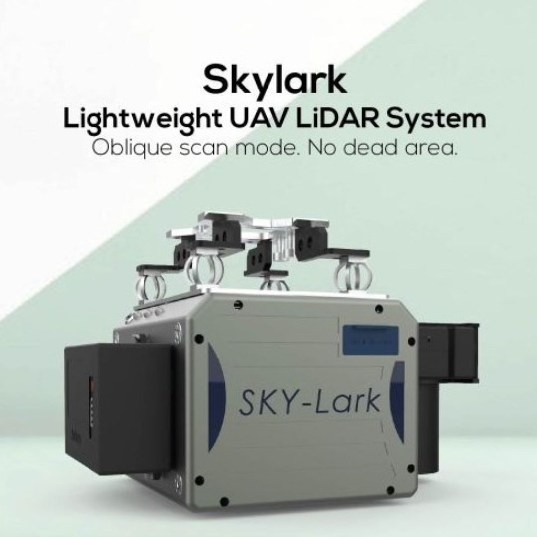
Highly integrated design gives the Skylark LiDAR its performance, stability and portability.
- 1
54 points per meter squared at 100km/h
• 70 degree FOV
• Oblique eclipse scan pattern
- 2
10mm laser precision
• 5cm vertical accuracy
• 700m maximum AGL
- 3
50-600kHz
• (600,000 points per second fired to the ground)
• 5.2Kg system weight
• All processing software included with system
- 4
Applications